EXPLORING THE KARAKUM
Among the unique corners of our planet, there are several dozen places where the land surface is located below sea level. For example, the lowest piece of land on Earth - 417.5 meters below the level of the oceans, is located on the coast of the Dead Sea. And the largest in area is the Caspian lowland, covering approximately 200 thousand square kilometers.
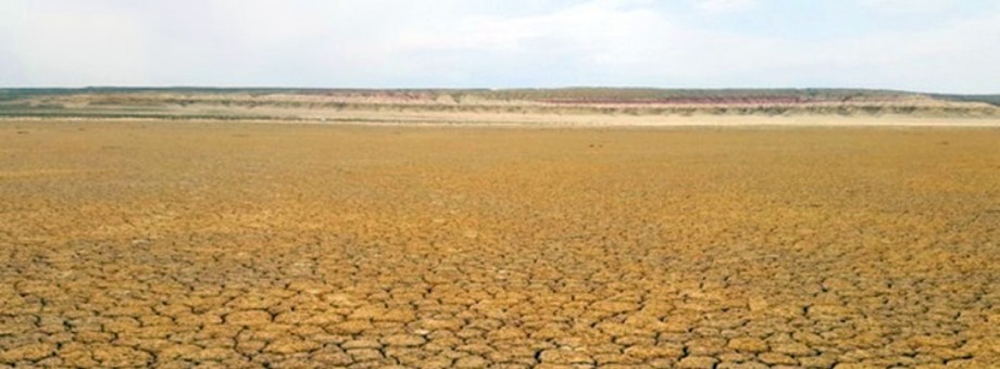
In Turkmenistan, the Akchakay depression is considered the deepest place within the land. Its depth relative to the level of the World Ocean is minus 81 meters.
The drainless depression is located in the northwestern part of the Karakum desert, in the Dashoguz velayat. Here, sandy hills suddenly give way to clayey takyrs, and an unusual landscape opens up a majestic panorama of the desert.
If translated from the Turkmen language, the name Akchakay or "Akja-gaya" means "white slopes". What is typical for this area, where white color prevails. The walls of the basin seem to be painted in white, pink and brown stripes. To match the layers of clay-carbonate rocks of marls and limestones.
There is a version among researchers that the depression was formed with the currents of ancient seas. Thanks to them, carbonate sedimentary rocks and fossils of unknown animals remained here. But it was not the sea that left the sand, which has been trying to fill up the depression for many years, but the mighty river, the deposits of which, according to scientists, laid down the sandy strata of the Karakum.
The clay bottom of Akchakay is dotted with patterns of cracks. Rain streams get here extremely rarely. And the water has nowhere to go. At the very bottom of the depression there are no dry channels, it is absolutely flat.
For comparison, the height difference between the lowest and highest point in Turkmenistan is more than 3220 meters. The top of the Airybaba peak in the Koytendag mountains is so much higher than the deepest point - the Akchakay depression in the Karakum desert.
https://turkmenistan.gov.tm/en/post/65709/exploring-karakum